Tetra Tech Honored at the 2020 MAPPS Geospatial Excellence Awards
Leveraging GIS and airborne remote sensing expertise for collaborative data sharing
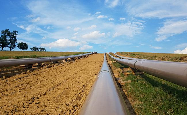
MAPPS honored Tetra Tech at their 2020 Geospatial Excellence Awards with an award in the GIS/IT/Remote Sensing Analysis category for our work on the Sunoco Pennsylvania Pipeline Project, also known as the Mariner East 2 Pipeline project.
Using our Tetra.Maps expertise, one of our foundational Tetra Tech Delta technologies, our team developed a powerful WebMap application for linear corridor projects that enables project stakeholders to work from the same approved dataset. This centralized data management system for all project information provides direct links to real-time content and data to minimize the risk of using out-of-date information. Airborne remote sensing data, field data, and analytics are carried throughout the project life cycle and into daily operations while maintaining continuity and accuracy, making it accessible to all approved personnel, both in the field and the office.
“The MAPPS Geospatial Excellence Awards showcase the outstanding projects conducted by MAPPS member firms over the past year,” stated MAPPS President Mark Brooks. “We honor all of our members for their achievements, and we congratulate Tetra Tech for their GIS and Remote Sensing award.”
Our Tetra Tech Delta combines deep operational expertise with our suite of proprietary tools and technologies to create transformational solutions for our clients. The WebMap application expands our solutions for projects that require remotely sensed data acquisition, data processing, data analytics, data sharing, asset management, route management, and project tracking and auditing.